
click for 5 extra photos
Contact Details:
Description:
Sorry, no additional information has been provided ...
Reviews
Aucun avis pour l'instant
Write a review
Directions
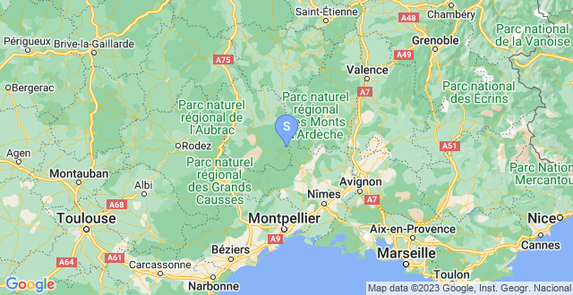
To reach La Donzelenche in the south of France, you will need to follow these travel directions:
If you are traveling by car, you can use GPS coordinates N 44º1952" E 03º5518" to navigate to the destination.
If you prefer to take a train, Montpellier is the nearest train station.
For those planning to travel by plane, you can choose between flying into Nimes or Marseille airports.
To find budget flights, you can check for available flights from Luton.
Map
Services
Attractions
- Pont du Gard: Located about 60 kilometers southwest of La Donzelenche, the Pont du Gard is a magnificent Roman aqueduct bridge that spans the Gardon River. It is a UNESCO World Heritage Site and offers stunning views of the surrounding landscape.
- Aven Armand: Situated approximately 25 kilometers northeast of La Donzelenche, Aven Armand is a vast limestone cave known for its exceptional stalagmite formations. Visitors can explore the underground chambers and admire the unique natural formations illuminated by creative lighting.
- Château de Portes: This medieval castle is located around 30 kilometers northwest of La Donzelenche. Château de Portes offers a glimpse into the region's history with its well-preserved architecture, defensive walls, and panoramic views. Guided tours are available to learn about the castle's fascinating past.
- Gorges du Tarn: Situated about 50 kilometers southeast of La Donzelenche, the Gorges du Tarn is a breathtaking canyon carved by the Tarn River. Visitors can enjoy hiking, kayaking, or simply taking in the stunning scenery from viewpoints along the road.
- Mont Lozère: Located approximately 20 kilometers south of La Donzelenche, Mont Lozère is the highest peak in the Cévennes National Park. It offers beautiful hiking trails, panoramic views, and a chance to experience the natural beauty of the region.
- La Bambouseraie en Cévennes: Situated about 30 kilometers east of La Donzelenche, this exotic bamboo garden is a unique attraction in the area. Visitors can explore the lush gardens, walk through bamboo forests, and discover various plant species from around the world.
- Uzès: Located around 70 kilometers southwest of La Donzelenche, Uzès is a charming medieval town known for its well-preserved architecture and historical sites. The town's highlights include the Place aux Herbes, the Duchy Castle, and the Uzès Cathedral.
- Lac de Villefort: Situated approximately 20 kilometers west of La Donzelenche, Lac de Villefort is a serene lake surrounded by picturesque forests. It offers opportunities for swimming, fishing, boating, and hiking along its shores.
- Château de Florac: Located about 40 kilometers southeast of La Donzelenche, this medieval castle overlooks the town of Florac. Visitors can explore the castle's towers, courtyard, and enjoy panoramic views of the surrounding landscape. 10. Vallon du Villaret: Situated approximately 15 kilometers northeast of La Donzelenche, Vallon du Villaret is a nature reserve known for its diverse flora and fauna. It offers hiking trails, picnic areas, and the opportunity to observe local wildlife in their natural habitat.